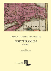
Ostthrakien, im wesentlichen das Gebiet der heutigen europäischen Türkei (Trakya), gehört als das direkte Hinterland von Konstantinopel, der mehr als eintausend Jahre bestehenden Hauptstadt des Byzantinischen Reiches (Istanbul), zu den historisch bedeutungsvollsten Landschaften im gesamten östlichen Mittelmeerraum. Die Region, die hier erstmals eine zusammenfassende Aufarbeitung unter historisch-geographischen Gesichtspunkten erhalten hat, grenzt im Westen an die Ägäis, im Süden an die Propontis, im Osten an das Schwarze Meer, die jeweils unterschiedlichen Klimaverhältnisse bedingen eine erhebliche landschaftliche Vielfalt. Besonders markante Stätten sind der Großraum Konstantinopel samt der Bosporos-Region, ferner das Gebiet um den „Heiligen Berg“ Ganos (Işıklar Dağı), die thrakische Chersonēsos sowie das reichbewaldete Istranca-Gebirge, in dem zahlreiche kaum bekannte Festungsbauten konzentriert sind. In Ostthrakien konnten in Auswertung der reich erhaltenen literarischen, archäologisch-kunsthistorischen und landschaftlichen Quellen sowie der Toponymik mehr als 700 Stätten aus Antike und Mittelalter dokumentiert werden. Die beigegebene Hauptkarte bildet die Region im Maßstab 1:800.000 ab, zudem zeigt eine Sonderkarte die europäische Bosporosküste im Maßstab 1:100.000. Der Band stellt einen Anschluss an die Bände TIB 6 Thrakien (Thrakē, Rodopē und Haimimontos), bearbeitet von P. Soustal, und TIB 10 Aigaion Pelagos (Die nördliche Ägäis), bearbeitet von J. Koder, P. Soustal und A. Koder, dar.
Gedruckt mit Unterstützung des Fonds zur Förderung der wissenschaftlichen Forschung
…
The 12th volume of Tabula Imperii Byzantini deals with the historical geography of Eastern Thrace in Antiquity and the Middle Ages. As the European hinterland of Constantinople, capital of the Byzantine empire for more than thousand years, the region was one of the most significant landscapes in the Eastern Mediterranean. Bordering on the Aegean in the west, the Sea of Marmara in the south and the Black Sea in the east the area is exposed to different climatic influences and shows a notable regional variety. Prominent places of Eastern Thrace are Constantinople with its suburbs and the Bosphorus, mount Ganos the "holy mountain" (Işıklar Dağı), the peninsula of Chersonēsos and the Istranca mountain with its numerous nameless fortresses. The introduction of the volume deals with
geography and climate, with history, traffic-routes and economy. Furthermore, an alphabetical catalogue offers more than 700 entries of settlements, place-names, fortresses, churches etc. from late Antiquity and Byzantine times; it was composed by using GIS, written, archaeological and toponymical sources. The main map of Eastern Thrace is drawn to a scale of 1:800,000, a more detailed map shows the Golden Horn and the European shore of the Bosphorus to a scale of 1:100,000. The volume adjoins to TIB 6 "Thrace" by P. Soustal and TIB 10 "The Northern Aegean" by J. Koder, P. Soustal and A. Koder.
2008,
978-3-7001-3945-4
978-3-7001-9598-6
782 Seiten, 144 SW-Abb. auf Tafeln, 2 Karten,
29,7x21cm, broschiert