|
 |
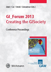
GIS as a technology has come a long way, from the
early adoption of technical wizardry to the ubiquitous,
if unconscious use by the masses. The creation
of the GISociety is on its way through technological
development, theoretical and empirical scientific
research and inclusion of technology into education
with increasing pedagogical justification.
Defining new dimensions of hard- and software,
brainware and orgware are all needed to further
develop the GISociety.
The Geoinformatics Forum (www.gi-forum.org)
held in Salzburg from July 2-5, 2013, links into these
research areas. We are pleased to present work
by researchers who actively contribute to the creation
of the GISociety in theoretical, technical, and
educational terms. This reflects that a GISociety can
only be created though close interaction among
the domains of science, technology and education.
Topics of the 2013 proceedings therefore include:
• Advances in Geographic Information Science
and Geographic Information Technology
• Spatial Citizenship
• Education for Digital Earth
• Ecosystem and Biodiversity Monitoring:
Best Practice in Europe and Globally (EO4Hab)
The book is aimed at researchers and practioners in
the field geoinformation with an academic, industrial
or educational background.
Work on this publication has been co-funded by the following projects and networks
funded by the European commission:
LLP-Comenius multilateral project SPACIT
(517908-LLP-2011-1-AT-COMENIUS-CMP)
LLP-Comenius network digital-earth.eu (510010-LLP-1-2010-1-AT -COMENIUS-CNW)
FP7-SPACE project MS.MONINA (FP7-SPA-2010-1-263479)
FP7-SPACE project BIO_SOS (FP7-SPA-2010-1-263435)
|

