 |
 |
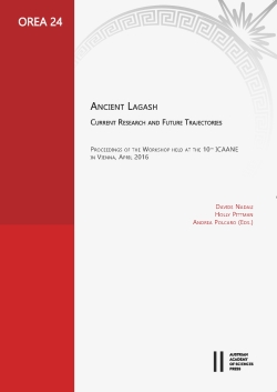
Ancient Lagash
|
 Davide Nadali is Associate Professor in Near Eastern Archaeology at the Sapienza University of Rome, Italy Holly Pittman is Director of the Final Publication Project of the Al Hiba Excavations and Director of the Lagash Archaeological Project Andrea Polcaro is Professor and Researcher in Near Eastern Archaeology at the Perugia University, Italy |
|
The State of Lagash was one of the major political powers in the Sumerian world of the 3rd millennium BC, with archaeological attestations at least since the 5th millennium BC. Located in present-day southern Iraq, this State incorporated three main cities: Girsu (Tello), Lagash (Tell al-Hiba), and Nigin (Tell Zurghul). The volume presents the results of studies and excavations carried on in these sites until 2015, providing new data for their historical interpretation. The volume collects contributions to the research at al-Hiba, under the supervision of H. Pittman, a section dedicated to the first archaeological campaign undertaken at the site of Nigin under the direction of D. Nadali and A. Polcaro, and the research on the site of Girsu under the joint direction of S. Rey and F. Husain. … |
 |
Verlag der Österreichischen Akademie der Wissenschaften Austrian Academy of Sciences Press
A-1011 Wien, Dr. Ignaz Seipel-Platz 2
Tel. +43-1-515 81/DW 3420, Fax +43-1-515 81/DW 3400 https://verlag.oeaw.ac.at, e-mail: verlag@oeaw.ac.at |
|
|
|||||||||||||||||||
|
DATUM, UNTERSCHRIFT / DATE, SIGNATURE
BANK AUSTRIA CREDITANSTALT, WIEN (IBAN AT04 1100 0006 2280 0100, BIC BKAUATWW), DEUTSCHE BANK MÜNCHEN (IBAN DE16 7007 0024 0238 8270 00, BIC DEUTDEDBMUC)
|

